Back in 2008 the City Council published an appraisal of the Eaton Conservation Area which includes interesting historical information about the area and our older buildings. You can read it here: Eaton_conservation_area_appraisal
Photos of Eaton
Norfolk County Council has a collection of photos that include Eaton. You can search through the archive for Eaton but this also includes many pictures taken by a local photographer named Eaton.
Here is a link to the site: NCC Picture Norfolk
The George Plunkett website also has photos of Eaton Village taken on Church Lane and Eaton Street during the 1930s.
http://www.georgeplunkett.co.uk/Norwich/#Chule
http://www.georgeplunkett.co.uk/Norwich/#Eaton
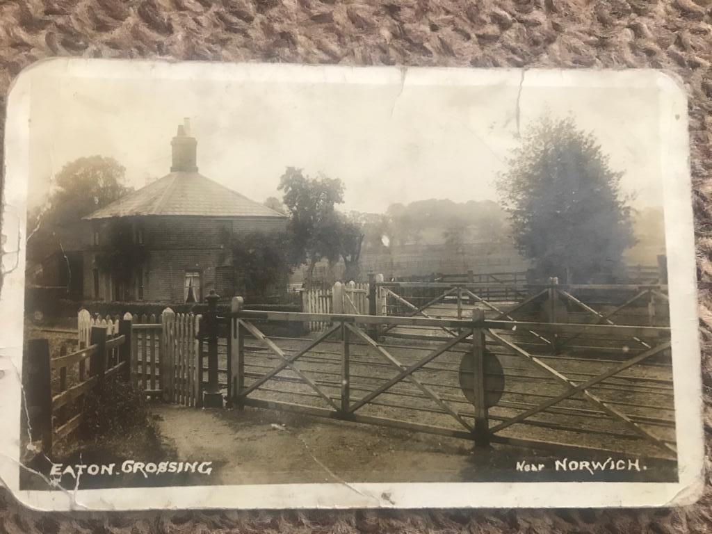
Here is an old photo of the railway crossing on Church Lane by Eaton Common. Don’t know the date.
Some history of Eaton Village
The photo below was posted on the Secret Norwich Facebook page by Tim Yau and provides a link to the history of our Village. It’s attached to a wall outside a property at the far end of Newmarket Road, just before you get into Eaton. The following information will be of interest to Eaton Residents who want to know more about the history of the area.
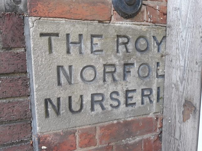
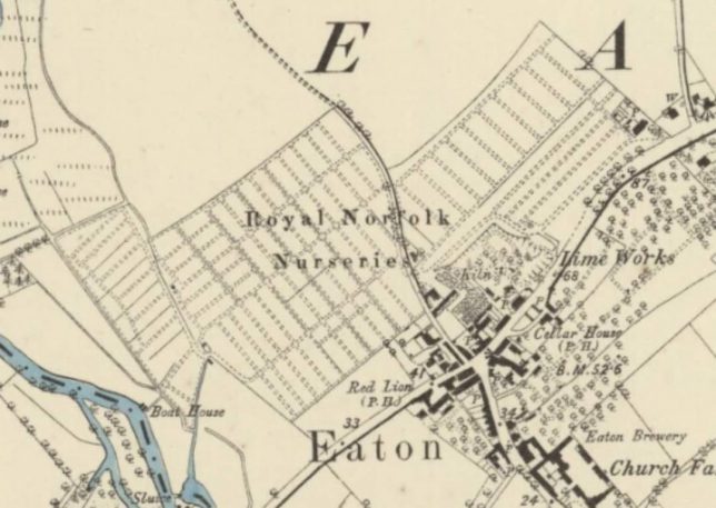
The Royal Norfolk Nurseries were run by the Ewings and here is a link to further information about the family and their connection with Eaton.
The Colonel Unthank’s Norwich website includes a blog post about the nurseries of Eaton provides further information:
eaton nurseries | Search Results | COLONEL UNTHANK’S NORWICH (colonelunthanksnorwich.com)
The map shows the section of Eaton where the nursery was located – largely what is now the other side of the A11 Cringleford bypass along Bluebell Road.
There are more maps of the area on the Norfolk County Council website where you can overlay maps from different times and toggle between them to see the changes over time.
Select the Map Explorer option to see the maps. Click on Flash player logo to activate this if the map page is not shown.
http://www.historic-maps.norfolk.gov.uk/
Another source of old maps is the George Plunkett website at: http://www.georgeplunkett.co.uk/Website/maps.htm
The Side by Side georeferenced maps site is a good way of looking at old maps compared to the current map of an area. This link will take you to the site: Side by side georeferenced maps viewer – Map images – National Library of Scotland (nls.uk)
Eaton Golf Club has written a history of the club which includes local information which will be of interest:
Our History – EATON GOLF CLUB (NORWICH) LTD (eatongc.co.uk)
A resident sent us this cutting from the Norwich Evening News from the early 1980s. The area between Cheyham Mount and the school was open land as seen in the photo.
The first houses were occupied in late 1983 in the area that is now Penshurst Mews, Wakehurst Close, Hardwick Close and the extension of Amderley Drive from the top of Cheyham Mount through to the school fence. Most of the blocks of flats envisaged did not get included in the final development.

Eaton Heath Barrow Cemetery – The Mobile Megalithic Portal includes a listing for Eaton Heath which is the area where the Primary School and Golf Course are located. The item can be read at: Eaton Heath Barrow Cemetery : The Megalithic Portal and Megalith Map:
The notes at the end of the item include a reference to Eaton Dell which is the area of woodland behind the bus stop on the slip road up to Newmarket Road from Bluebell Road. The dell was probably the area from the Eaton Street cross-roads much of which disappeared when the by-pass was built in the mid 1970s. Prior to 1975 Eaton Street was the main A11 road into Norwich.
Eaton Chalk Quarry
Eaton Chalk Quarry is located between Newmarket Road and Greenways/Donkey Lane. The entrance to the old quarry is on private land and has been sealed with a cage to protect a colony of bats. There is information and photos of the old quarry on the Geograph website at: Eaton Chalk Quarry [22 photos] in TG2006 :: Geograph Britain and Ireland